Utah Topographic Mapping & Surveys
Utah Topographic Mapping Services
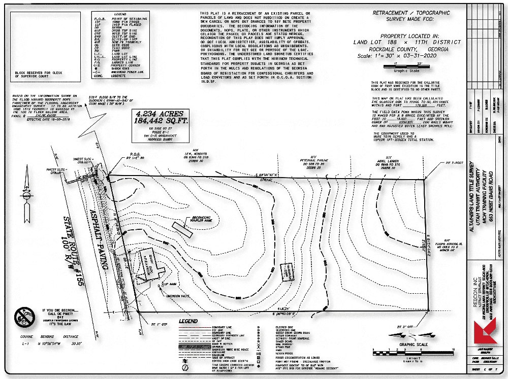
Topographic mapping and existing-conditions surveys with CAD-ready deliverables for residential projects, GCs, commercial contractors, and design/build teams. Built for Utah terrain, municipal submittals, and real field conditions.
Topographic mapping services we provide
REDCON provides topographic mapping services and topographic surveys built for residential development, commercial construction, and municipal decision-making in Utah. You tell us what you need the map to do—permit, design, staking, quantities, or closeout—and we scope the fieldwork and deliverables to match.
- Topographic mapping (topo maps) and existing-conditions surveys for residential and commercial lots
- 3D modeling and surfaces (DTM / existing ground) as scoped
- Plan exhibits and permit drawings
- Volume calculations (earthwork / stockpiles)
- Construction as-built surveys and record documentation
- FEMA mapping support and elevation-related documentation when required
CAD / GIS deliverables
We can provide printed or digital deliverables depending on your workflow. Common outputs include:
- Plan and profile sheets (as scoped)
- Cross sections
- Site plans and land exhibits
- As-built drawings / record drawings
- Condemnation plats (when applicable)
- Digital terrain mapping and surface files
- Route planning before installing a new service
- Tracing a specific utility run
- Electronic “trial hole” support (non-destructive investigation)
- Mark-out on the ground and/or color-coded data overlaid on topo/CAD
Service area
Based on scheduling and scope, we work throughout Utah, including Salt Lake, Davis, Weber, and Utah counties.
FAQ
- Do you do topographic surveys for residential homes?
- Yes. We frequently provide topographic mapping for residential projects, including new home construction, additions, and landscape design. These surveys help architects and engineers plan for drainage and grading.
- What do you need from us to start?
- Address or limits of work, desired deliverables (DWG/PDF/surface), and schedule. If you have drawings, send what you have—we’ll align the scope to your build plan.
- Can you tailor deliverables for our design team?
- Yes. Tell us the coordinate system, layer standards, and output format you want. We’ll deliver CAD-ready files your team can use.
Get a Free Quote
Tell us what you’re building. We’ll confirm scope, schedule, and deliverables.
Centerville, Utah 84014