
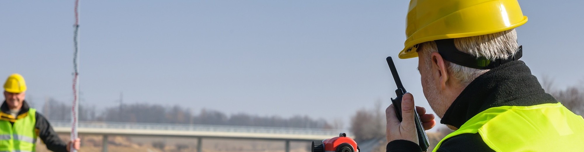
REDCON’s professional land surveyors use the timed-flight, pulsed 3D laser scanner to take a three dimensional image of the item or geographical area being scanned.
Through the use of this HD 3D scanner 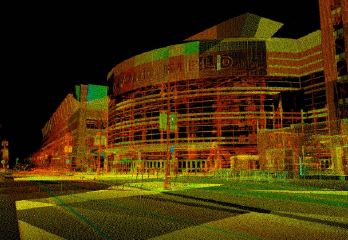 system, REDCON can effectively survey items with a high level of detail, from a safe distance. Areas that previously had to be “touched” to obtain survey data are now captured completely from a distance of up to 200 meters away.
Our 3D scanning services are available throughout Utah and the Intermountain West (Idaho, Wyoming, Nevada, and Arizona).
Accuracy and Scalable Detail
The 3D laser scanner system sends multiple beams; the REDCON technician pre-defines spacing of these beams over the surface being scanned. Each beam returns a signal to accurately define the surface of the item.
In areas where a high level of detail is required, our surveyor defines a tighter spacing of the beams. Typically beam spacing is in the order of approximately one grid pattern. Beam spacing can be defined at 1/32 of an inch if required.
Safer and Less Costly Transportation Projects
The benefits to transportation projects are immense. Existing structures can now have digital “as-built” drawings with real world coordinate integrity in a cost-effective and timely manner.
High levels of detail can be provided without the need for a surveyor to enter the travel lanes. The safety factor alone is a huge step forward from conventional technologies. But there are also cost savings that result from not having to close lanes to perform surveys.
Reliable Forensic Surveying with HD 3D Scanning
For forensics surveys, a 3D scan can preserve the scene without causing any evidence to be touched, which means it is held in high regard during legal proceedings. It also creates a factual picture of a location which can be presented in place of questionable eyewitness testimony or potentially faulty memory from a lengthy trial or arbitration.